Crowdsourcing in the developing world is helping understand the earth
Researchers on the CrowdLand project, funded by the EU’s European Research Council, are building mobile games and apps in order to get people to send them pictures, observations and location-specific information on land cover using their cameraphones, in the hope they can use the data to generate better land use maps.
That's critical becase information on crop locations and irrigation conditions are vital if governments are to ensure adequate, sustainable food production and safeguarding food security.
The researchers have already trialled similar technology in Europe as part of the international Geo-Wiki project, an interactive online project that involves citizen scientists in global land cover research.
Geo-Wiki has already led to its contributors corroborating over 2.5 million square kilometres of land cover data, an area greater than half of the EU.
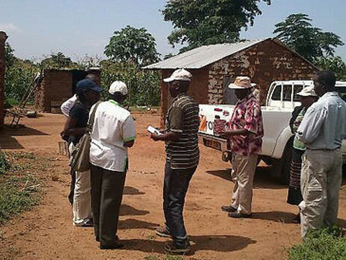
The researchers decided to turn their attention to Africa because mobiles are increasingly abundant in developing countries, which now account for four in every five new connections worldwide. However data on land-use in these countries is patchy and incomplete, leading researchers to investigate whether this information could be crowdsourced from local people via their phones.
“‘We are building apps whereby users can take a picture of a place we are interested in and tell us what the land cover is.’
'We have been using mobile devices for data collection in the past ... therefore it came naturally to use mobile phones,' said principal investigator Steffen Fritz.
The goal is to use social gaming to generate an openly accessible archive of geographically located pictures, information on land characteristics, and other observations of research and educational value. The work is being trialed in Austria, before it will be adapted for use in Kenya. In Kenya, the researchers say they may change the incentives and could make small payments.
Next 50 years
‘We are trying new methods of data collection involving people on the ground,’ said Fritz. ‘This information will feed into global land use change models which will provide us with information on how land-use might change in the next 50 years and to understand where the changes are occurring.’
Plugging the holes in existing data is important to get an accurate picture of food production and environmental change. The information that is gathered can then be used to inform decision-making in the areas of agriculture, health, and environmental management.
The question is how to incentivise people to contribute information. ‘We are testing whether citizens like farmers and students in Kenya will be willing to provide us with this data in return for services, such as targeted weather services and market information, or simply financial incentives,’ said Fritz.
‘More and more people in the developing world can afford smartphones, so we are building apps whereby users can take a picture of a place we are interested in and tell us what the land cover is and we will put 50 cents into their bank account.’
Privacy matters
However, this increasing use of smartphones to collect information means that people are continually sharing their location and other personal data, which raises the question of data protection.
In the developed world, data is protected by laws and regulations, but in much of the developing world no such protection exists. Without legal, cultural, technological and economic infrastructures, competing interests in data can’t be properly balanced, which leads to its misuse.
Now, an EU-funded project called D4D is working out what kind of digital data protection is needed to protect people in low-income countries, and make sure that the potential benefits of knowing more about developing countries is weighed against the risks of being able to track and identify individuals and groups.
‘People can do things in the developing world that they’d never do in the developed world because it would be illegal,’ said Linnet Taylor, a researcher on D4D, which runs until 2016. ‘There is going to be less social pressure to regulate information in developing countries and that’s a problem.’
To help solve this, Taylor is hoping to work out what research ethics should look like with regard to personal digital data, and how the companies that collect data should behave in places where their home regulations don’t apply.
Recommended for you


