European Commission logo

Earth observation

The full Mediterranean 'data' package
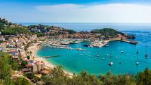
An EU-backed research team is developing a new interoperable and cost-effective platform to integrate and package marine and coastal data from sensors, together with oceanographic models and mobile applications for improved observation and forecasting across the Mediterranean Basin.

Add to pdf basket

Preparing for climate change: geospatial services for Europe's cities

It's hard to map a path forward if you don't understand the lie of the land. City planners concerned with the implications of climate change thus need detailed information on the districts within their remit. New services developed by EU-funded researchers are available to support them with intelligence notably derived from Earth observation and open data.

Add to pdf basket

Young scientists hone skills one cloud at a time

A group of young researchers spent the past couple of years with their heads in the clouds... to better understand aerosol cloud interactions and how they can help predict climate change. The project also led to technological advances in remote-sensing instrumentation and picked up the pace for technological transfer from research to industry.

Add to pdf basket

Geoscience tools help us better manage Earth's resources

Soil, water and metals are being exploited by agricultural practices, mining and human consumption faster than ever before. To better manage our use of these precious resources, we need to understand how they are made and destroyed at molecular level. On a mission to join the dots and help us use the Earth's resources more sustainably, the EU-funded IsoNose project is using isotopic techniques to measure geochemical processes.

Add to pdf basket

A creative space for fab innovations

European universities are being encouraged through an EU-funded initiative to set up platforms to boost innovation and co-creation around the use of geo-data and other space-based applications. Their uses range from satellite navigation, geo-mapping and renewable energy to agriculture planning and other areas.

Add to pdf basket

An integrated observing system for the Atlantic Ocean

Buoys, floats, moorings and research vessels, to name just a few examples - data about the state of the Atlantic is collected by a number of means. And by a profusion of actors, who could jointly produce even better results if they applied a common strategy. EU-funded researchers are driving the development of an integrated system.

Add to pdf basket